
Recommended hardware: GNSS receiver (GPS/GLONASS/Galileo), Bluetooth Low Energy 5.0, LTE‑M/NB‑IoT or GSM fallback, accelerometer for motion detection, and either a replaceable coin cell (CR2032) or a rechargeable Li‑ion battery. Typical performance: GNSS accuracy 5–10 m outdoors, BLE proximity 1–3 m at short range, cellular-based location 50–500 m; device size around 60×40×12 mm and weight 30–70 g; battery life ranges from 2 weeks to 12 months depending on reporting cadence.
Operational sequence: the unit attempts a GNSS fix when motion is detected, caches coordinates locally, and transmits to the vendor cloud over the mobile network when coverage is available. If no cellular link exists, it emits BLE beacons that can be picked up by nearby smartphones or dedicated gateway networks and relayed to the cloud. Configure reporting frequency based on need: 1–5 minute intervals for live position updates, 15–60 minutes while in transit, and motion-triggered sleep to extend battery life.
Data security and service economics: pick a provider that uses TLS for uplinks, token-based authentication and per-device identifiers. Expect data retention options from 30 to 90 days and export in CSV/KML for claims. Global connectivity is usually provided via eSIM or roaming SIM; anticipate monthly plan costs in the range of $1–5 or pay-as-you-go data billing.
Placement and operational tips: place the unit away from thick metal panels or heavy electronics–an external pocket or fabric liner improves GNSS fix rates. Keep the device accessible for battery replacement. During flight, cellular transmissions cease; rely on BLE sightings or the last-known coordinates until ground networks resume. Record the serial number and activation timestamp for faster interaction with ground handlers.
Practical setup checklist: register the device immediately after activation, enable push notifications and shared location links, set motion-triggered reporting with a 5–15 minute active interval during transport, and choose a vendor with crowd-gateway coverage at major airports to maximize chances of prompt recovery.
Operation and setup for a smart suitcase locator
Enable the device’s flight profile and confirm full charge 24 hours before travel to maximize uptime and avoid airline issues.
Technical components and typical performance
Most units combine a Bluetooth Low Energy beacon, a GNSS receiver (GPS/GLONASS), a cellular modem (NB‑IoT/LTE‑M or 2G fallback) and a motion sensor. Expected performance: GNSS continuous tracking drains a rechargeable cell within 24–48 hours; intermittent GNSS with 1–15 minute reporting intervals usually yields 5–21 days; BLE-only beacon mode on coin cells can last 3–12 months depending on advertising rate. Outdoor GNSS accuracy typically 3–10 m under clear sky; BLE proximity detection precision is 1–30 m and depends on phone model and antenna orientation.
Configuration, connectivity and costs
Pairing: open the companion app, enable Bluetooth and location permissions, scan the QR/ID on the unit, assign a name and set geofence radius (recommended 100–300 m for airports). Reporting interval options commonly include 30 s, 1 min, 5 min, 15 min – choose longer intervals to extend battery life. Data path: device attempts direct GNSS→cellular upload; if cellular unavailable it relies on BLE beacons detected by other users’ compatible apps (crowd-assisted last‑seen). Typical subscription pricing ranges $2–8/month for global SIM plans; pay attention to roaming coverage maps and annual vs monthly billing.
Security and privacy: enable app encryption, create a strong account password, turn on two-factor authentication if offered, and limit shared access to individual trips only. For firmware updates accept only signed releases delivered through the official app.
Placement and airport handling: place the unit in a secure interior pocket or attach it to a rigid frame to avoid antenna blockage. Most devices use small coin cells or low‑capacity lithium polymer packs under regulatory thresholds for checked baggage, but policies vary by airline – when in doubt carry the unit in cabin and switch to airline profile on request.
Troubleshooting checklist: verify battery level in app, ensure phone Bluetooth and background location are granted, restart the device with the manufacturer’s button sequence (commonly press-and-hold 10 seconds), update app and firmware, confirm active subscription and cellular credit if applicable. If GNSS fix fails repeatedly, try relocating the bag to a position with open sky for at least 2 minutes.
For maintenance replace user-replaceable batteries per manufacturer intervals, remove personal data and perform a factory reset before transferring ownership, and keep firmware current. For unrelated travel snack guidance see which nuts have the most protein and least fat.
Sensors and network connections used to locate your suitcase
Enable cellular data, Bluetooth and location permissions; position the device near the bag surface (avoid complete metal enclosure) and keep its battery above 20% for consistent fixes.
-
GNSS module (GPS / GLONASS / Galileo):
Primary source for precise coordinates outdoors. Typical horizontal accuracy: 3–10 m with clear sky. Time-to-first-fix (cold start) without assistance: 30–120 s; with Assisted GNSS (A-GNSS): 5–30 s. Operates on L1/E1 bands (~1575 MHz) and GLONASS L1 (~1602 MHz).
-
Cellular radio (GSM / 3G / LTE / LTE‑M / NB‑IoT):
Provides location by cell ID or multilateration when GNSS is unavailable (indoors, inside vehicles). Coarse accuracy ranges from ~100 m in dense urban to several kilometers in rural. LTE‑M and NB‑IoT variants greatly reduce power draw (sleep currents in µA) and are preferable for long battery life; active transmit currents typically 50–200 mA.
-
Bluetooth Low Energy (BLE):
Used for short-range pairing and crowd-sourced detection via smartphones. Advertising range commonly 10–30 m depending on antenna and obstruction; average current while advertising: 1–10 mA. BLE presence enables rapid local re-discovery and reduces need for power-hungry GNSS checks.
-
Wi‑Fi scanning:
Scans for SSID/BSSID fingerprints to derive position when GNSS is weak. Typical fingerprinting accuracy: 10–50 m in built-up areas. Scans are brief bursts of 2.4/5 GHz radio activity; avoid disabling Wi‑Fi scanning if you rely on indoor detection.
-
Inertial sensors (accelerometer, gyroscope, magnetometer):
Motion sensors detect movement and orientation changes to wake high-power modules only when needed. An accelerometer threshold prevents unnecessary GNSS fixes while the bag is stationary, extending battery life. Magnetometer provides coarse heading useful for dead-reckoning over short intervals.
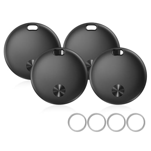
Must-HaveIMSVEPR Bluetooth Tracker Tags 4 PackLoud sound alerts for lost itemsThe IMSVEPR Bluetooth Tags help you keep tabs on your belongings effortlessly with real-time tracking and sound alerts. Designed for iOS users, they ensure your items are never lost again. -
Barometer / altimeter:
Provides relative altitude changes (floor vs ground, lift/aircraft) with resolution ~0.1–1 m; useful to disambiguate locations in multilevel structures or detect loading into cargo holds.
-
NFC (in some models):
Used only for local provisioning and secure pairing; not for continuous positioning. Range <10 cm; negligible power draw when inactive.
Accuracy trade-offs and power numbers
- GNSS: best accuracy (3–10 m) but highest energy per fix (30–100 mA during acquisition).
- Cellular: energy moderate during transmit bursts; location coarse (100 m–km), but provides global coverage and works inside many vehicles and terminals.
- BLE & Wi‑Fi: low energy, useful for crowd-sourced and local detection; range limited to tens of meters.
- Sensor fusion: combining GNSS + cellular + BLE + inertial data improves continuity indoors and reduces unnecessary GNSS activations.
Practical configuration recommendations
- Use a SIM with roaming enabled or global IoT plan if you travel internationally; choose LTE‑M/NB‑IoT when available for longer battery life.
- Allow background location and Bluetooth permissions in your phone app so crowd-sourced networks can report sightings.
- Keep the unit on the outer side of the bag or in a fabric pocket; avoid tight placement against metal frames or densely packed electronics to prevent RF attenuation.
- Enable A‑GNSS/assisted data updates and install firmware updates to improve fix time and cellular handover logic.
- If frequent interior tracking is required, prefer a model that supports Wi‑Fi scanning and BLE advertising for denser detection points inside terminals and vehicles.
Install and pair the tag with the official mobile app – step-by-step
Insert a new CR2032 (3 V) cell, confirm + side faces the spring, and wait for two short green flashes within 5 seconds before opening the companion app.
-
Phone requirements and app download
- Android 8.0+ or iOS 12.0+; Bluetooth Low Energy 4.2+ required.
- Install the manufacturer’s companion application from Google Play or the App Store; ensure app version is 1.5.0 or later if shown in the store notes.
-
Pre-pairing phone settings
- Enable Bluetooth.
- Enable Location Services for the app: on Android grant “Allow all the time” if shown; on iOS allow location and enable Background App Refresh for the app.
- Exclude the app from battery optimization / Doze modes so background scans are not suspended.
-
Power the tag into pairing mode
- Press and hold the tag button for 3 seconds; LED should pulse blue (pairing advertising) for about 60 seconds.
- If LED shows alternating red/blue, the unit is in factory-reset state and can be added as new.
-
Pair through the app
- Open the app and tap “Add device” or the “+” icon.
- Choose the device model from the list if prompted; the app will scan and display available tags by last 4 characters of serial.
- Select the matching serial, confirm the serial shown on the tag’s packaging or label, then tap “Pair”. Expect the first connection to complete within 10–30 seconds.
- If firmware update appears, keep phone and tag within 1 metre, keep the app foregrounded; update typically takes 2–4 minutes.
- Assign a recognizable name (e.g., “Blue Suitcase” or “Checked Bag 01”) and save.
-
Post-pair configuration
- Allow push notifications so the app can send loss/return alerts.
- Enable continuous location or background tracking if the app offers a toggle; this improves last-seen accuracy when the phone is not actively using the app.
- Set separation distance alerts and sound volume in the device settings inside the app.
Troubleshooting quick checklist
- No device found: move tag within 1 metre of phone, toggle Bluetooth off/on, retry scan.
- No LED response: replace battery; check polarity; try a different CR2032 brand.
- Pairing fails during firmware update: keep phone screen awake, disable VPN, and avoid switching apps; restart phone if progress stalls for more than 5 minutes.
- Transfer tag to another account: perform factory reset (hold button 10 seconds until rapid red/blue flash), then re-pair under new account.
Placement tips
- Install the tag inside an outer pocket or on the top interior panel to maximize Bluetooth reach while keeping it protected from impact.
- Avoid placing tag directly behind dense metal plates or sealed luggage wheels; small fabric barriers have negligible effect.
- For frequent air travel, check battery level in the app before departure and carry a spare CR2032.
Additional resources and related gear: best backpack brands for work
Location updates during flights, layovers and baggage claim
Charge the unit to at least 50% before check-in; enable Bluetooth, GPS and cellular roaming in the companion app and grant background location permissions so the unit can resume transmissions immediately after ground connectivity returns.
In-flight: when aircraft rules force cellular radios off, the unit generally cannot send live fixes. Internal accelerometer and time-stamped logs record movement while airborne; some models continue low-power Bluetooth advertising if airline policy allows. The first outbound network report typically appears after landing and reconnection to terrestrial networks or nearby mobile devices, producing a timestamped location that reflects post-touchdown position rather than continuous airborne tracking.
Between flights (layovers): while the bag is on airport conveyors or in transfer vehicles, connectivity depends on whether the unit is within cellular, Wi‑Fi or Bluetooth range. If in a terminal with coverage, the unit will resume periodic GPS or cell-based fixes (typical uplink interval 2–10 minutes). If inside sealed cargo transfer or a vehicle, expect prolonged offline intervals with only inertial logs until a ground connection is re-established.
Baggage claim: once the suitcase reaches the claim area and the unit regains line-of-sight to satellites or cell towers (or a nearby smartphone running the same network), an immediate location update is triggered. Time from arrival at claim to the first visible fix commonly ranges from 1 to 10 minutes; reported accuracy will be GPS-level (5–30 m) when unobstructed, or cell/Wi‑Fi-based (50–300 m) when satellite signals are blocked.
| Phase | Connectivity state | Update trigger | Typical delay | Expected accuracy |
|---|---|---|---|---|
| On board (cruise) | Cellular off; possible BLE advertising; GPS may be blocked | Reconnection after landing or BLE pickup by nearby phone | From touchdown to first report: 1–20 minutes | Logged movement; transmitted fix reflects post-flight location |
| Taxi/transfer between terminals | Intermittent cellular/Wi‑Fi; often shielded in cargo | Regain cellular or BLE coverage; store-and-forward on reconnect | 5–60 minutes (depending on handling) | Cell-based: 50–300 m; GPS if available: 5–30 m |
| Layover on ground (in terminal) | Cellular/Wi‑Fi available | Periodic GPS/cell fixes per device settings | 2–10 minutes between updates | GPS: 5–30 m; Wi‑Fi: 20–100 m |
| Baggage claim / post-collection | Unobstructed cellular and GPS | Immediate uplink on first network contact | 1–10 minutes | GPS: 5–30 m; cellular: 50–200 m |
Practical adjustments: place the unit near the top interior panel (less metal shielding), keep SIM/data active for global roaming if the model supports cellular uplink, enable the app’s crowd-sourcing features so other users’ devices can relay anonymous fixes, and allow background app refresh and push notifications to receive the first available update after each offline period.
Monitoring battery life, using power-saving modes and replacing the battery
Set two low-battery alerts in the companion app (20% and 10%), and check the device battery percentage at least once per week; enable push notifications for immediate warnings rather than relying on manual checks.
Interpret status indicators: steady green or a full battery icon = >70%; amber or half icon = 30–70%; red or flashing red = 10% per day) while idle, open Settings > Diagnostics and record a screenshot for support.
Expected runtimes by configuration: continuous GPS-level updates (1 Hz) typically yield 12–48 hours; default periodic reporting (every 5–15 minutes) commonly gives 2–4 weeks; motion-triggered or deep-sleep modes can extend service to 3–6 months. Use these figures to choose reporting intervals based on trip length.
Power-saving recommendations: increase the reporting interval to 15–60 minutes when fine-grained tracking isn’t required; enable motion detection so the unit sleeps while stationary; switch off nonessential radios (cellular/GPS) and rely on Bluetooth scanning when the companion phone is nearby; disable LED and haptic alerts; schedule nightly sleep periods for predictable inactivity. In the app: Settings > Reporting interval, Settings > Motion sensitivity, and Device > Power options.
Replacing the cell battery (coin cell models): confirm model number on the device label and buy the exact cell type (commonly CR2032, 3 V). Steps: power the unit off in the app, remove two screws or twist-open cap per the device design, lift out the old cell noting polarity (+ side up), insert the new cell with identical polarity, reseal and hand-tighten screws (avoid over-torquing), power on and verify percentage and a test location ping. If an O-ring seals the case, replace it or lubricate with silicone grease to preserve water resistance; a damaged seal will void water-resistance ratings.
Rechargeable-battery models: perform a full charge cycle once after replacement (charge to 100% then allow one full discharge to 10–20%) to recalibrate the fuel gauge. Use only manufacturer-specified chargers and cables; do not substitute lower-voltage sources. Avoid swapping non-rechargeable coin cells into rechargeable circuits and vice versa.
Disposal and care: recycle used cells at a designated collection point; do not cut or puncture batteries. Store spare cells at 20–25°C, away from metal objects. If battery drain remains abnormal after replacement, capture logs in Settings > Diagnostics and contact support with serial and firmware version for a replacement assessment.
Roaming, SIM/data plans and privacy settings that affect location reporting
Enable international roaming on the device SIM or install a global/M2M SIM and pick a data plan sized for your reporting cadence: 50–100 MB/month for hourly updates, 200–500 MB/month for 5–15 minute updates, 1 GB+ for continuous frequent reporting or long trips across many borders.
If roaming is switched off at the SIM or carrier level, the unit will stop sending cellular location updates once outside the home network; verify roaming status with the carrier and confirm roaming APN is allowed. Preferred SIM types: multi-operator M2M/eSIM profiles that automatically register on local networks (MCC/MNC switching). Avoid single‑country prepaid SIMs unless you plan to replace them at each border.
Data usage estimate: each cloud location report (HTTPS + TCP overhead) typically consumes ~0.5–4 KB. Multiply by reports per day: e.g., 12 reports/hour × 24 = 288 reports → ~150 KB–1.2 MB/day. Add firmware check-ins and push notifications; choose a plan with headroom (recommended: 20–30% margin).
Companion app and OS permission settings
Grant the companion app unrestricted background network access and precise location: Android – App permissions → Location → Allow all the time; Settings → Battery → Exempt app from optimization; Data saver → Unrestricted data access. iOS – Settings → Privacy → Location Services → select Always and enable Precise Location; Settings → General → Background App Refresh ON for the app. If the app is denied these, background polling, push refreshes and Bluetooth reconnection behavior can be blocked; map pins will show only the last cached coordinates.
Privacy controls, account settings and pre‑travel tests
Review the service privacy settings: disable unnecessary location sharing, set shortest server retention where available, enable end‑to‑end/TLS connections, and turn on account 2FA. VPNs or firewall rules on your phone may block push notifications but do not prevent the device from reporting via its own SIM. Before departure: power the unit, trigger a manual report, cross a border, confirm MCC/MNC change in the device log or cloud console, and verify timestamps and signal strength. If reports stop after a border crossing, check roaming enablement and APN values with the SIM provider.


